The high-altitude balloon flight OH3HAB #7, launched on September 2nd 2023 by amateur radio club OH3AA in Hämeenlinna, Finland, was a special flight with two new technical experiments: a RadSens radiation sensor based on a Geiger tube and an image transmitter using the Wenet modulation. The flight payloads included a Vaisala RS41 radiosonde that was repurposed for amateur radio use and a Raspberry Pi Zero W with a Uputronics LoRa board to transmit photographs. With the transmissions of the position and image data available for anyone to receive easily, tracking of the flight became a true community effort!
Videos
An overview of the flight launch, balloon burst and landing. Watch the epic landing in a river and recovery of the flight payloads using a boat:
Vaisala RS41 radiosonde with a radiation sensor
The flight used a Vaisala RS41 radiosonde again as the main flight tracker. The radiosonde was modified to transmit on the amateur radio 70cm band (432.500 MHz) and to send both Horus 4FSK and APRS packets with the GPS position and telemetry data from the sensors. The Horus transmission can be received by anyone with an SSB receiver for the 70cm band and a computer running the Horus GUI software!
RS41 radiosondes are reusable and launched daily by meteorological institutes around the world (FMI in Finland), which makes them great for tracking amateur radio high-altitude balloon flights. Read more about repurposing radiosondes for amateur radio high-altitude balloon tracking.
![]()
The RS41 radiosonde was equipped with a Geiger tube-based sensor for ionizing radiation, called RadSens, and a Bosch BME280 temperature/humidity/pressure sensor. Both of the sensors were connected to the I²C bus of the radiosonde.
![]()
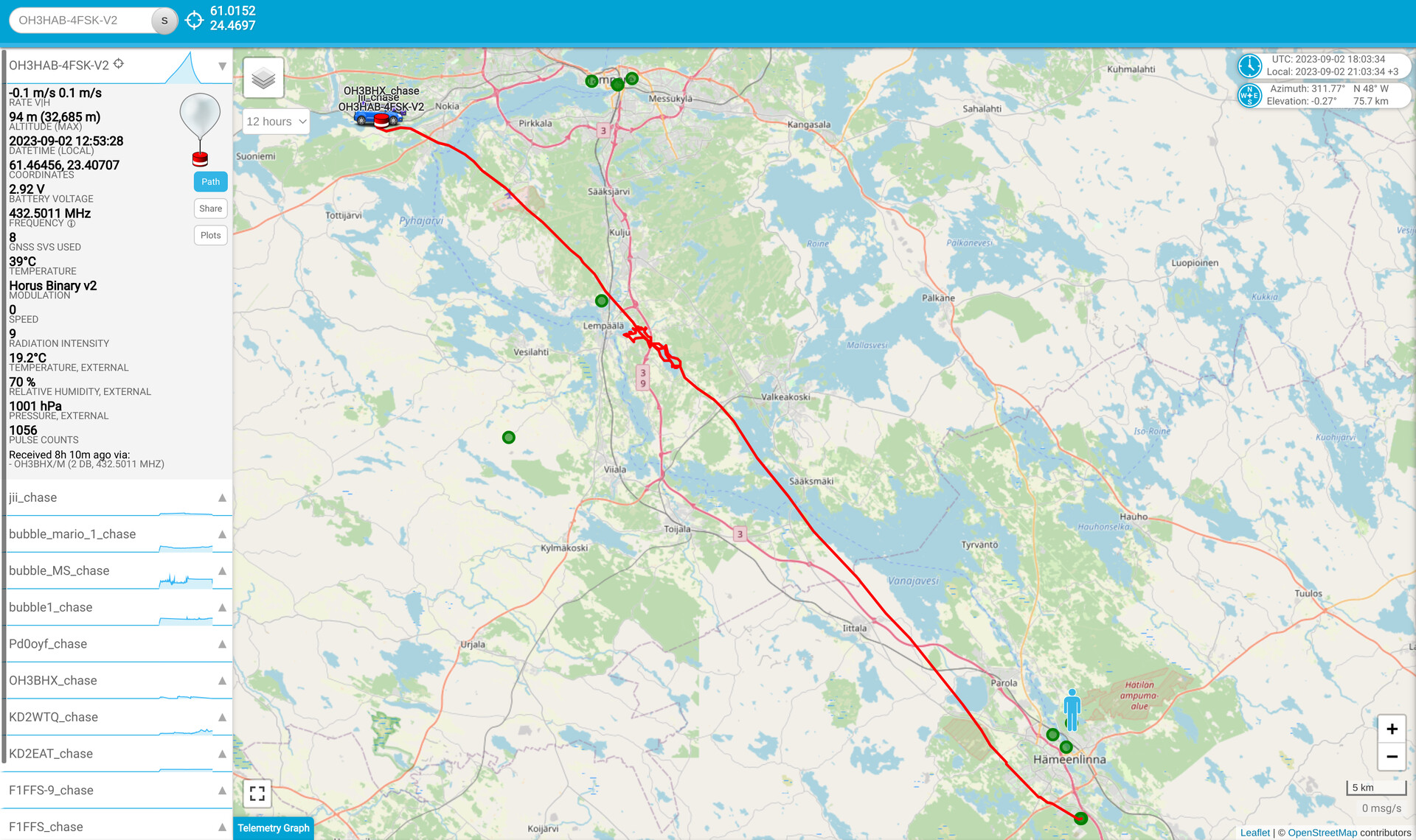
Flight path and landing
The flight path forecasts from the predict.sondehub.org flight prediction service were again quite reliable. The prediction indicated that the maximum altitude for a 600g latex balloon and a payload of about 600g with an ascent rate of 5 m/s would be just over 30 kilometers. The upper atmosphere winds on the morning of the launch day would take the balloon to the northwest direction, towards the city of Tampere. The final forecast on Saturday morning showed the northwest part of the city of Nokia as the landing site, while earlier in the week the forecasts predicted the Kulju area as the landing site. The challenge in landing in the Nokia area is the large number of water bodies, which would make it more likely for the balloon payloads to fall into the water.
Horus 4FSK and Wenet reception details
The OH3AA club receiver was a long cross-yagi antenna with a preamplifier. We used the same yagi to receive both the Horus and the Wenet transmissions. The technical specifications of the yagi were excellent for receiving Wenet images, but for some unknown reason the Wenet receiver station did not work at all. There was a problem with the receiving equipment or some possible local transmission was interfering with the Wenet reception.

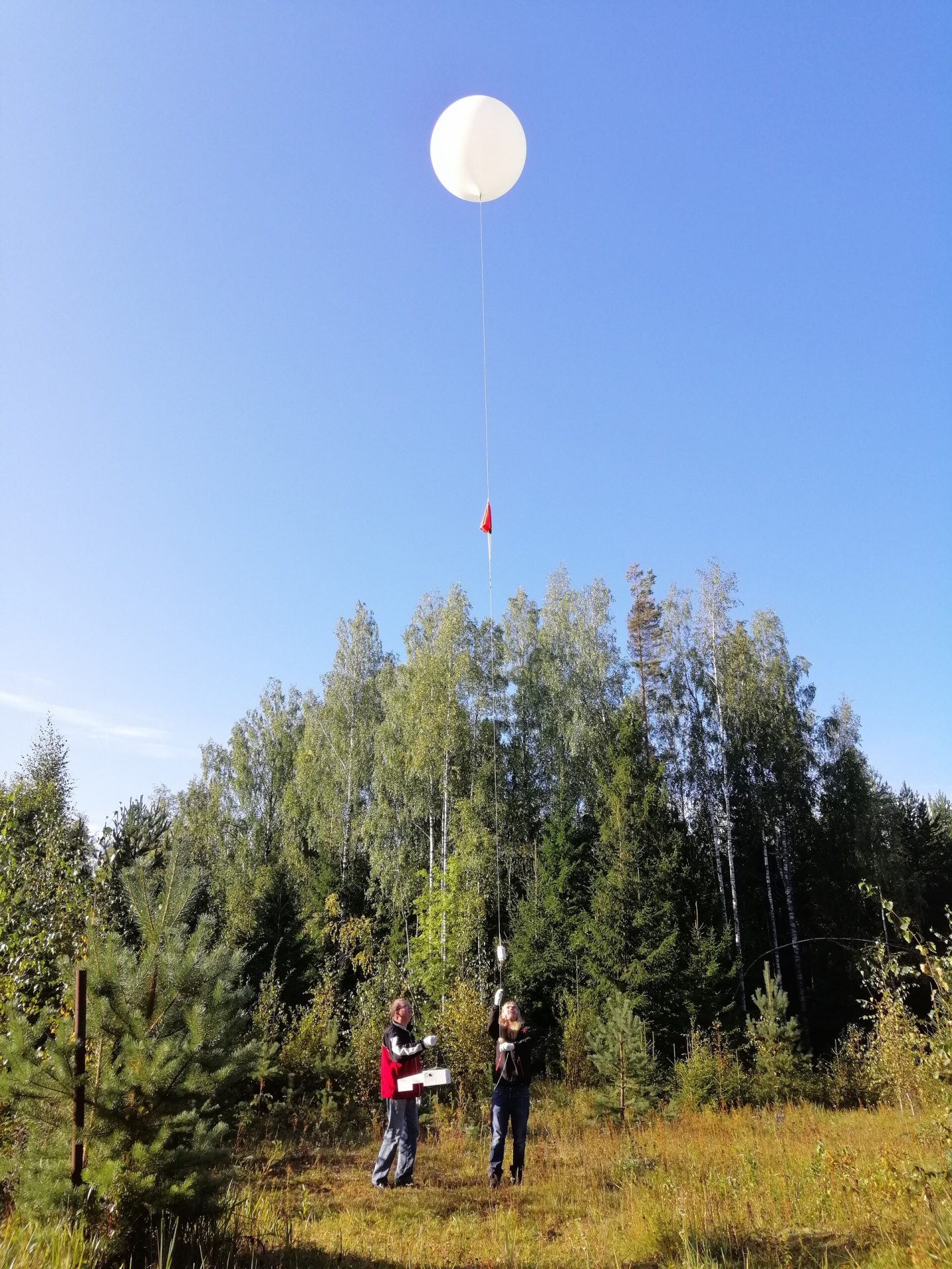
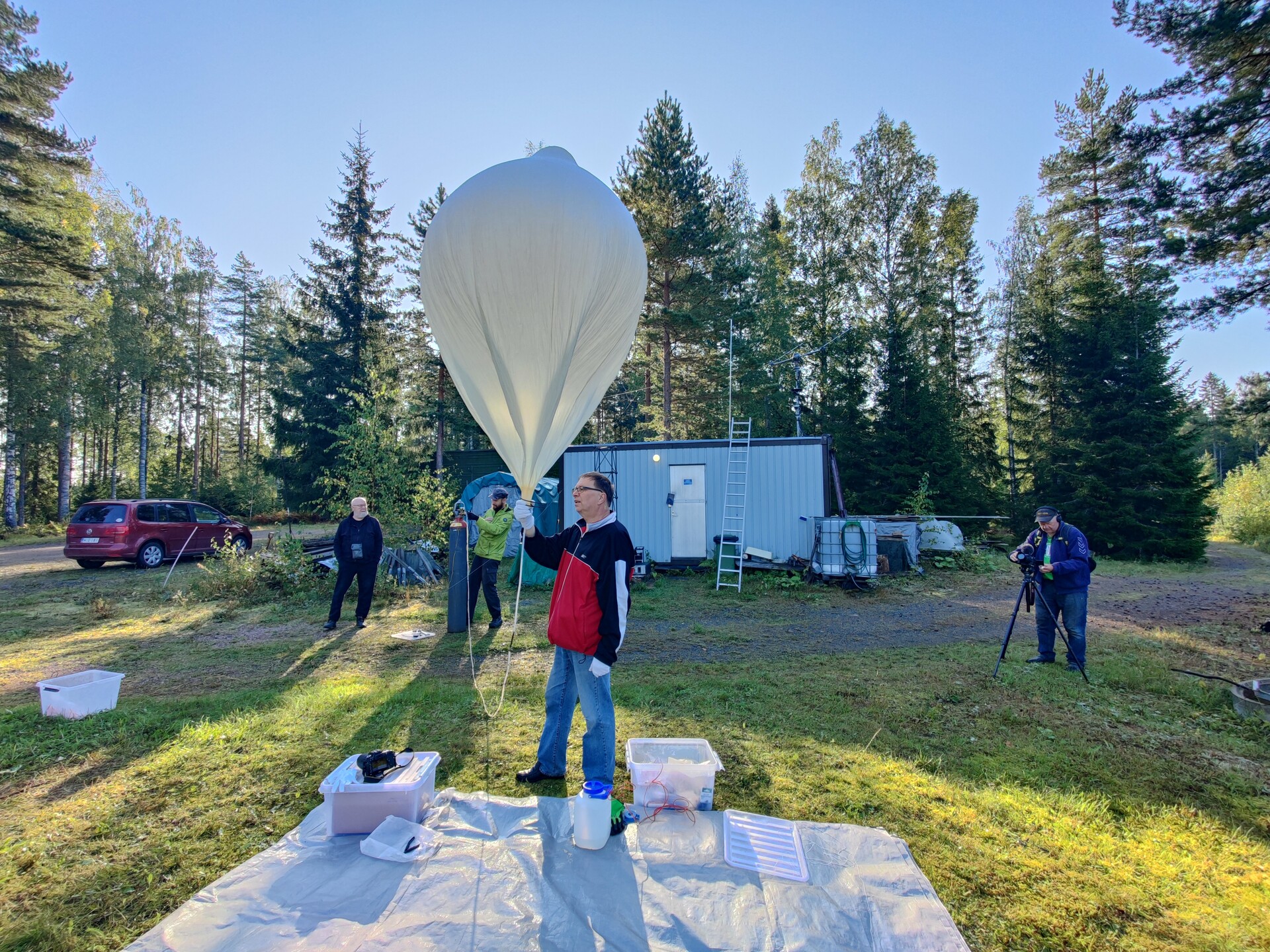
Flight preparations and launch
The weather forecast for the launch weekend was quite challenging, because there were a lot of rain areas nearby and the winds in the upper atmosphere were strong. However, Saturday morning September 2nd was sunny and calm, so we agreed to launch the balloon at 9:00 AM local time. We were at the launch site already before 8:00 to start preparations for the flight. The next rain area would reach the launch site around 11:00 AM, so we didn’t have time to waste!